APPLICATION AND CASE
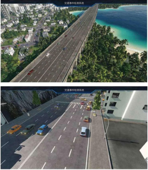
The system can accurately perceive the road. By detecting the status, speed, direction, location and other information of road participants (people, vehicles and non motor vehicles), the system can detect and statistically analyze the traffic parameters such as abnormal parking, retrograde or reverse, queue overrun, spills, pedestrian crossing, Lane flow, average speed, space occupancy, density and so on in real time;
Based on advanced technologies such as high-definition monitoring, video image detection and recognition and system integration, it can recognize the face features of vehicles and drivers, analyze illegal behaviors, and store data, so as to complete the research, judgment and evidence collection of traffic violations. At present, through big data and artificial intelligence algorithm technology, more than 30 kinds of illegal acts can be analyzed and obtained. Solve the problems encountered by the traffic control department in the scenes of illegal behavior judgment and illegal audit.
Through multi-dimensional perception equipment, each target identified in the video is given a real-time latitude and longitude spatial coordinate accurate to sub meter level. Combined with 2D / 3D digital map, the real-time digital reconstruction of people, vehicles and roads in the real world is carried out, the real-world 1:1 digital image is constructed, the digital twin city and digital twin highway are realized, and the overall sense of monitoring is effectively solved The pain points that cannot be monitored in the blind area are of great value to traffic simulation, road congestion early warning, road abnormal event detection, road emergency disposal and rescue, vehicle road coordination, etc.
-
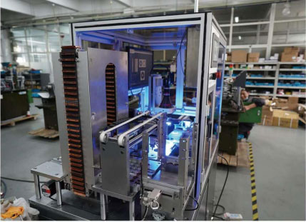
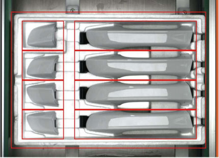
Product appearance quality inspection
Various ng types often appear in industrial parts, such as lack of material, scratch, bump, deformation, blockage, etc. there are problems of detection accuracy and visual fatigue in manual detection of small parts. AI appearance quality inspection scheme, relying on Al depth visual detection technology, can greatly reduce missed detection and false detection under the condition of complex texture image classification and background interference, which is accurate and controllable, Synchronization realizes the real-time synchronization of detection result data, realizes the efficient and fast iterative closed-loop of data model, and continuously improves the accuracy of field model.
-
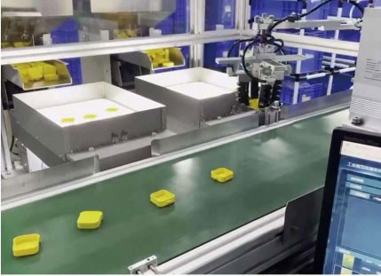
Intelligent sorting of goods in production process
The traditional industrial robot sorting system can not meet the requirements of high recognition rate and high precision because of its complex shape, different posture and dense parts. In the AI based machine vision sorting system solution, the deep learning al detection image scheme is used to improve the recognition accuracy and positioning accuracy, so that it can adapt to a more complex sorting environment and better complete the sorting task.
-
Misplacement inspection after product assembly
Assembly lines often appear on the production line, such as whether the parts are placed in the specified order and whether the parts are assembled into new parts according to the regulations. There will be quality and scene learning problems in manual processing. For example, there are dozens of placement orders corresponding to specific models. Different assembly requirements require a lot of manual experience, and new employees are prone to missed inspection. Through the learning and analysis of AI images, fine troubleshooting is realized, which greatly improves the inspection and assembly efficiency of the production line.
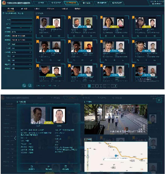
Through the real-time comparison between the system captured face and the specified registry, the comparison is an alarm to display the alarm content. At the same time, the alarm records produced by the system are statistically saved, which can be targeted to the interested groups according to the characteristics of the case, such as collecting face, viewing playback, trajectory analysis, etc.
The system records the face photos captured by all cameras. Through the "face frequency" function, the frequency of specific monitoring bayonets of the target personnel in a certain period of time can be statistically analyzed, so as to facilitate the selection of suspicious personnel's clear face and the analysis of activity range and time, and provide effective clues for police research and judgment.
The system can capture the personnel according to the front-end monitoring points, and the background automatically forms the track map of specific personnel in a period of time. The presentation of the map in the system will be realized according to the outdoor GIS map technology. The location of the alarm is displayed intuitively in a graphical way, so that the personnel who are not familiar with the monitoring area can also know the specific location of the alarm location, which is conducive to rapid dispatch.